

History
Originally known as Civic Park and St. Gabriel’s Park, the park was renamed in May 1978 in recognition of the adjacent St. Vartan Armenian Cathedral on Second Avenue and East 35th Street.

The gold-topped St. Vartan Armenian Cathedral appears adjacent to the western side of St. Vartan Park
The park was contiguous until the construction of the Tunnel Approach Street for the 1940 Queens-Midtown Tunnel cut the park in two. As a result, the shape of the park resembles an exclamation point.

A vintage postcard purchased from atop the 1931 Empire State Building captures from the building the park then known as St. Gabriel’s Park, below a Con Edison steam station (middle, dark square structure with stack) near the East River
A journey through the park’s history is presented through images and publication excerpts on this page. Additional archival content appears on other pages on this site, including many photos on the garden page.
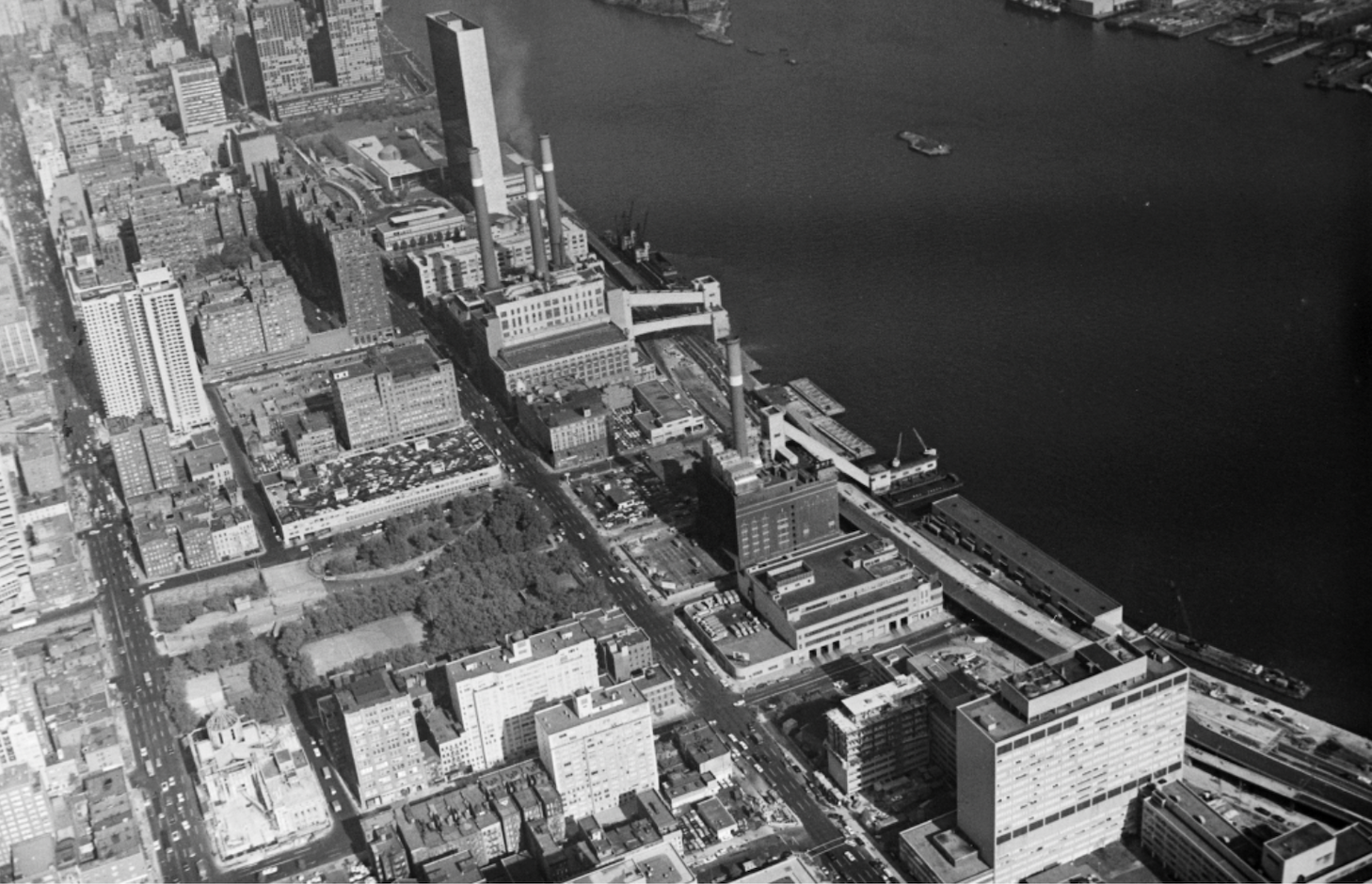
The tree-enhanced park appears at center left on October 26, 1966 | New York Department of Ports and Trade
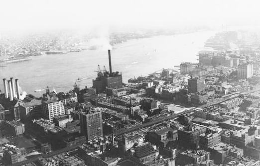
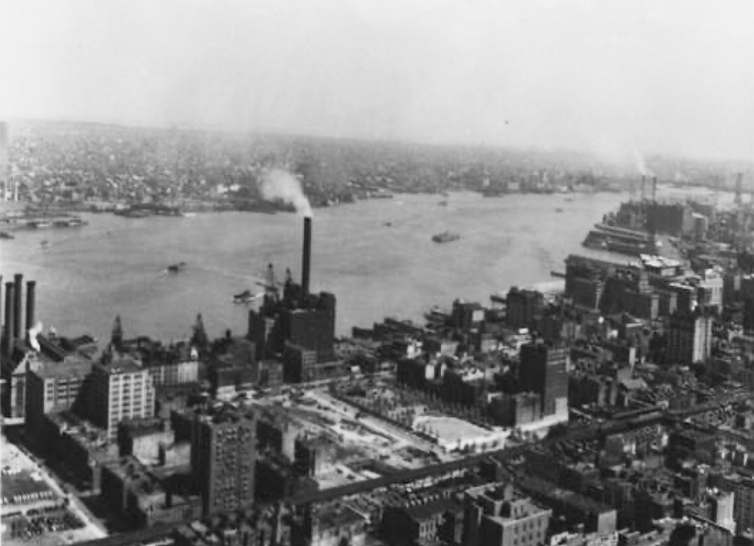
An October 3, 1936, view shot from atop the Chanin Building at the corner of 42nd Street and Lexington Avenue shows the park then known as St. Gabriel’s Park in center between two since-razed structures — a Con Edison steam station (with tall dark stack near the East River) and the Second Avenue elevated train tracks | P.L. Sperr
Retrospection
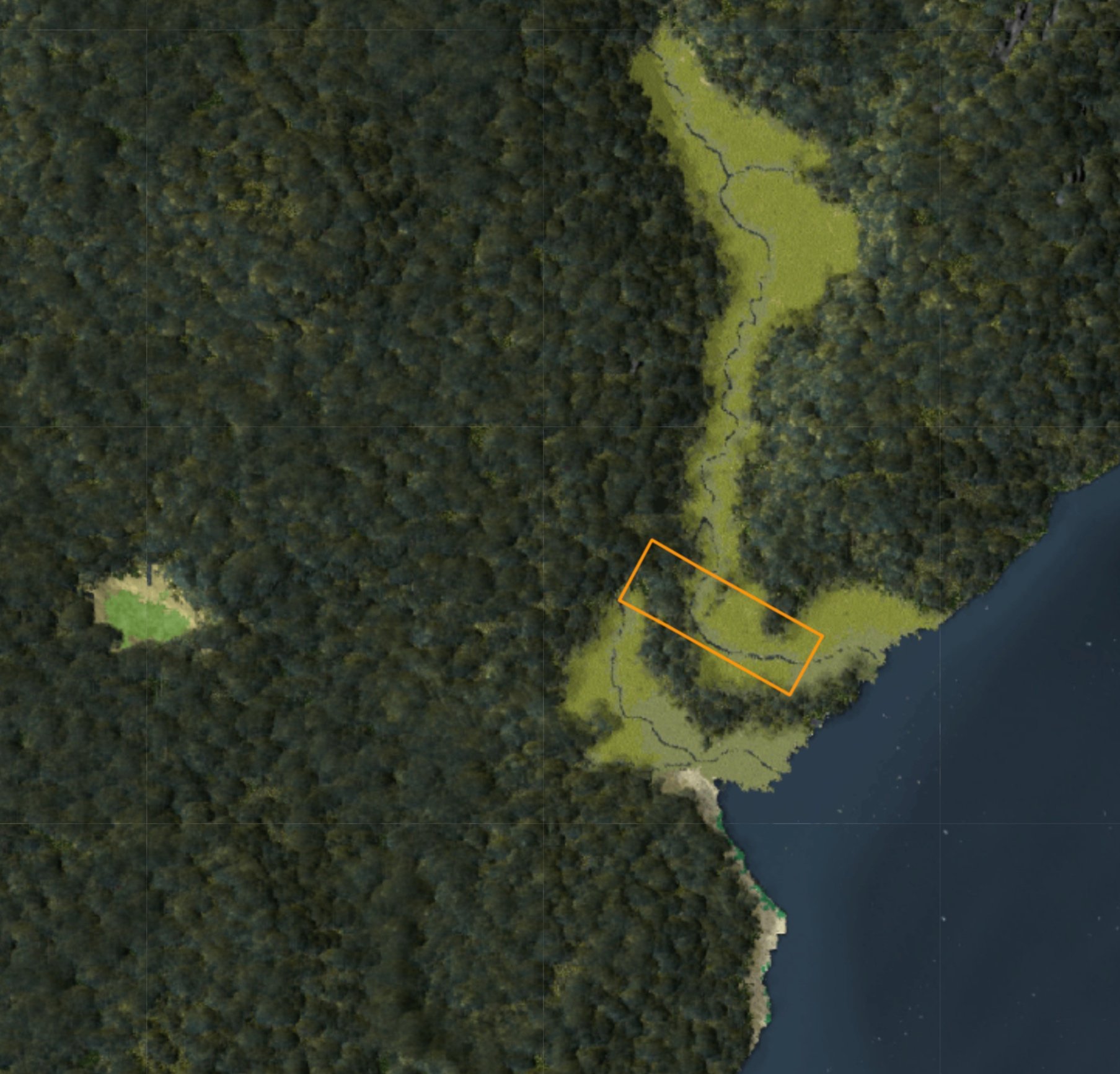
In this rendering from the Welikia Project that imagines how today’s New York City land appeared in 1609, the land that would become St. Gabriel’s Park is plotted by the project with an orange border.
“Early topographic maps suggest that there is one location . . . that would have had characteristics attractive to Native Americans, at Second Avenue and 42nd Street . . . a well-drained area north of a stream that crossed Second Avenue at 37th Street and that emptied into the East River less than one block away. The [Second Avenue and 35th Street] area at St. Vartan Park was once located between two streams that emptied into Kips Bay on the East River. The area would have had a riverine and an estuarine environment, making it suitable for hunting, fishing and, just east . . . collecting of shellfish. It also may have contained discrete sections of habitable land.”

The location of what is now St. Vartan Park appears In the “Keps Bay” area of this map made from surveys conducted in 1766 and 1767 | The Plan of the City of New York in North America by Bernard Ratzer, printed in 1770
“. . . treading on historic topography . . . In 1665, Jacob Kip finished his home on a site between 35th and 36th Streets just east of Second . . . was destroyed in 1850 [when it was the oldest house in Manhattan] . . . Kips Bay itself extended inland to mid-block between First and Second Avenues. In September 1776 [from] the bay, 4,000 British and Hessian soldiers invaded Manhattan and routed the green Connecticut troops, who fled west. General George Washington failed to rally his army . . . and the Americans retreated . . . The British held Manhattan for the next seven years. ”

Part of a 1865 topographical map shows that the original water course of the actual Kips Bay (blue in center, with meadow in light green, marsh in dark green and “made land” in orange) reached Into what today is the eastern end of St. Vartan Park | Topographical Map of the City of New York Showing Original Water Courses and Made Land prepared under the direction of topographical engineer Egbert L. Viele
“Not only was General George Washington entertained in the [Kip] house, he used it briefly as his headquarters during the Revolution . . . Washington returned at least once and received an impressive gift, at least for the time. Sometime shortly after Washington’s [1789] inauguration . . .’now invested with Presidential honors, made an excursion, and was presented with the rosa gallica, an exotic first introduced into this country in this garden—fit emblem of that memorable union of France and the American colonies in the cause of republican freedom.’”
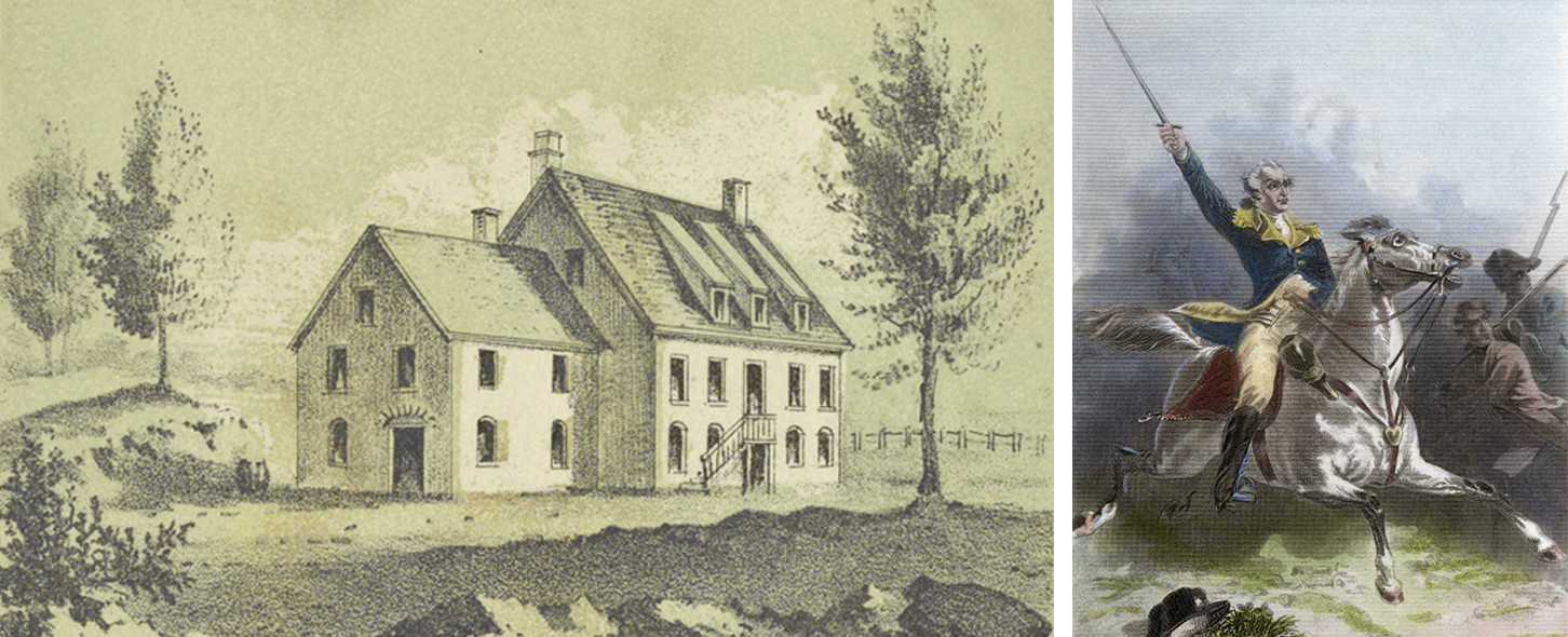
Left: Jacobus Kip’s house, on land that is reportedly on what is now part of the south side of St. Vartan Park | George Hayward lithograph courtesy of New York Public Library
Right: George Washington depicted in the September 15, 1776, Battle of Kips Bay | 1875 steel engraving by Henry Louis Stephens

Part of a drawn map published in 1879 shows the block bordered by First and Second Avenues and 35th and 36th Streets (middle, second full block from top) was well developed before the park arrived | The City of New York drawn by Will L. Taylor published by Galt & Hoy, courtesy of Library of Congress
The New York Times, June 27, 1901:
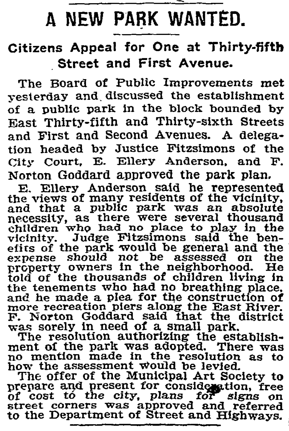
“Mayor Van Wyck to-day approved a ordinance passed by the Municipal Assembly, providing for the laying out of a small public park bounded by Thirty-fifth and Thirty-sixth streets, First and Second avenues, Manhattan, and authorizing condemnation proceedings for acquiring the land A delegation of property owners from the Twentieth Assembly District appeared before the Mayor, and urged him to sign the ordinance. He complied without comment.”
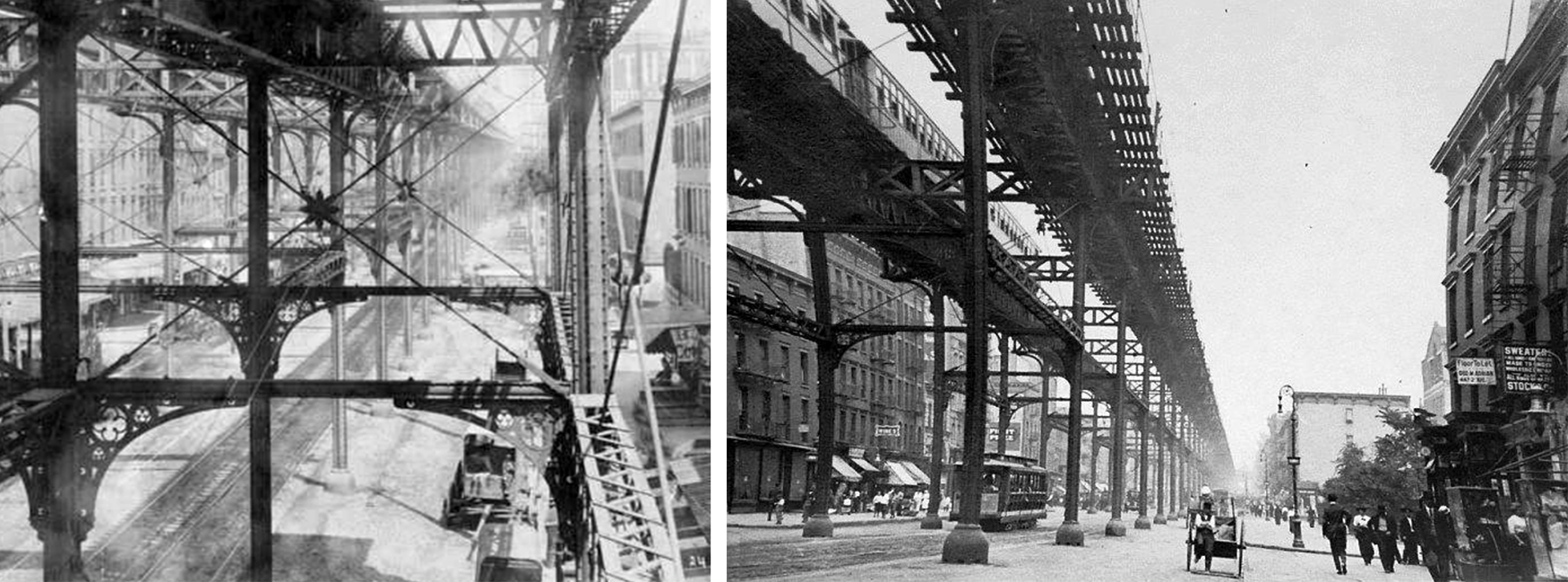
Left: This 1890s northward shot of the Second Avenue elevated train line was taken from 34th Street, with the second block on the right — Second Avenue between 35th and 36th Streets — the future west end of the park | Photograph courtesy of New York Public Library
Right: A 1905 photograph is captured on Second Avenue, looking northward from between 34th and 35th Streets with the west end of the new park on the right between 35th and 36th Streets | Photograph courtesy of the City of New York
“A contract for this park has been let, the design including permanent playground features. This park is small in area, covering but one city square, but the plans have been designed to make the best possible use of every available inch of space.”
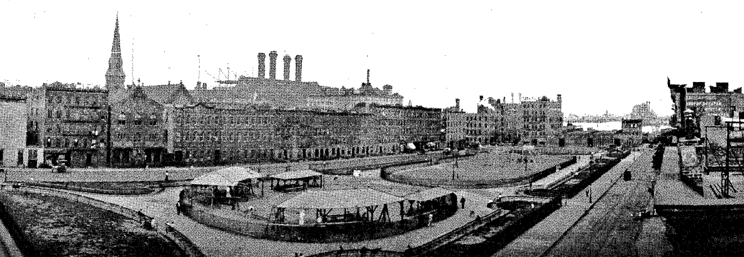
St. Gabriel’s Park in 1908 lies between East 35th Street and East 36th Streets in view of the East River and the steepled St. Gabriel’s Church | New York City Department of Parks Annual Report, 1908
“Work on this improvement . . . consisted of the general excavation of rubbish, bricks, walls . . . and all foreign materials, and placing fresh, clean, wholesome earth filling in enhancement and slopes . . . 8,000 cubic yards of excavation of all kinds removed, 3,000 cubic yards of filling furnished in place.”
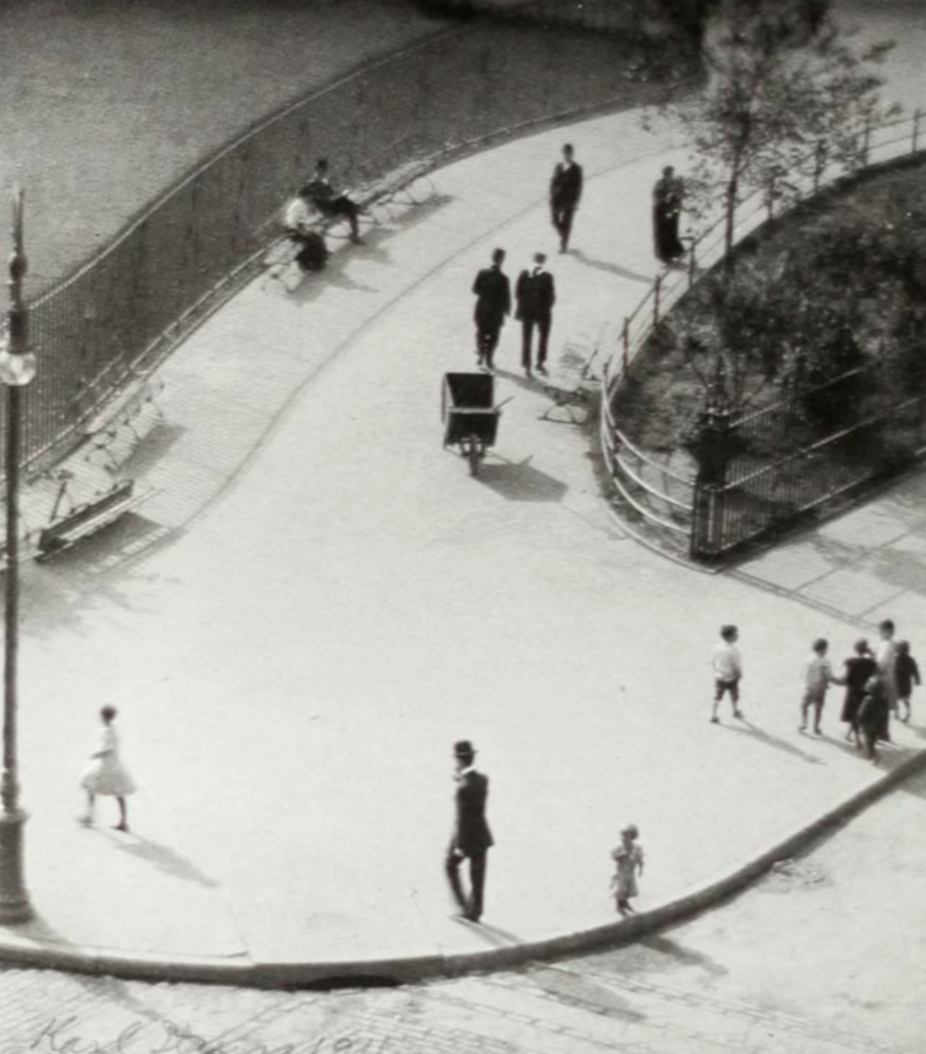
St. Gabriel’s Park, 1911 | Karl Struss
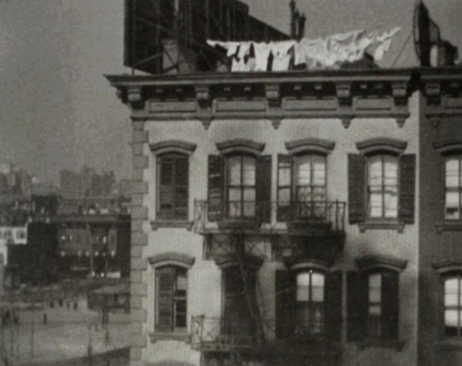
St. Gabriel’s Park (lower left),1911 | Karl Struss
“The park . . . takes in the square between Thirty-fifth and Thirty-sixth Streets, and First and Second Avenues, formerly a crowded tenement block. The work of demolition of the old tenement structures was begun February 3, 1904, and the improvement has hastened in every possible way . . . The destruction of the tenements has left the site covered with rubbish and debris to a depth of seven feet, but the work of removal will be completed in a few months. ”
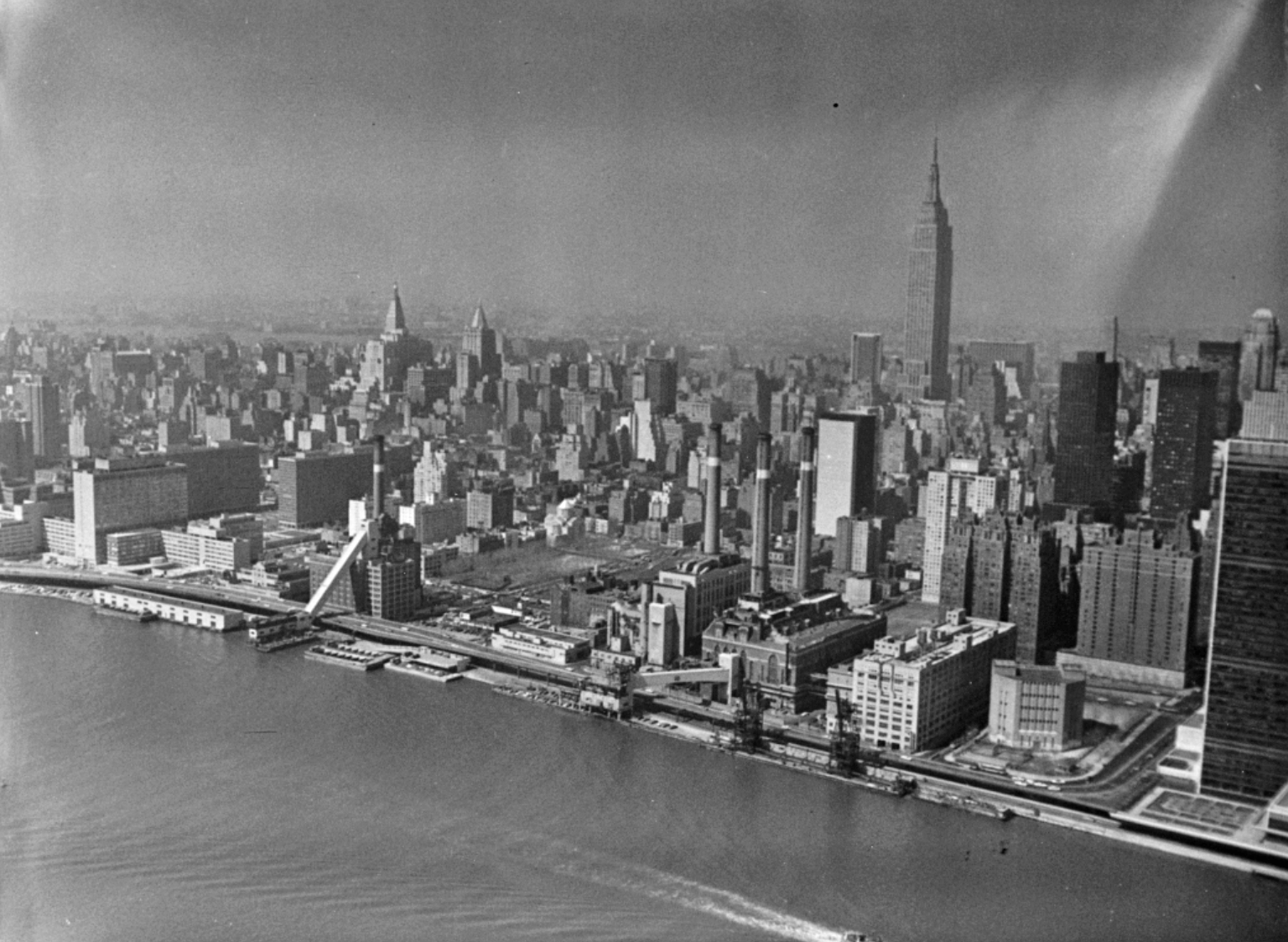
The park appears at center west of the East River and FDR Drive on April 8, 1970 | New York Department of Ports and Trade
“. . . it was natural to begin at once to try and secure for the new neighborhood a park. . . We began by getting the use of two adjoining lots as a playground which we called the Kips’ Bay Playground. The interest of St. Gabriel’s Parish in this matter was great. That large parish, whose pastor was later Cardinal Farley, had the interests of its children close to its heart. Cooperating with them, St. Gabriel’s Park finally came into existence as the flowering of the Kips’ Bay Playground.”

A 1926 view of East Midtown Manhattan dominated by Edison Company smokestacks shows the northeast corner of St. Gabriel’s Park on the far left near the bottom of the photograph | Fairchild Aerial Camera Corporation
“The Park Board last September announced the name of the park as Civic Park.”
“A number of residents in the neighborhood of Civic Park . . . have begun a fight against the proposition of William J. Boyhan, the Tammany Alderman of the district, to change the name of the park to St. Gabriel’s. The credit for getting the park in the district, it is asserted, belongs to the Civic Club, which has its home in the neighborhood. The protest against the change is made in the name of a number of Catholics, who declare that the change would be an injustice to the Civic Club . . . A public hearing has been asked for on the resolution, but it is likely that the request will be discharged.”
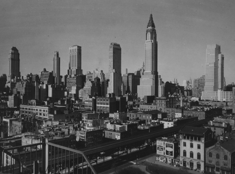
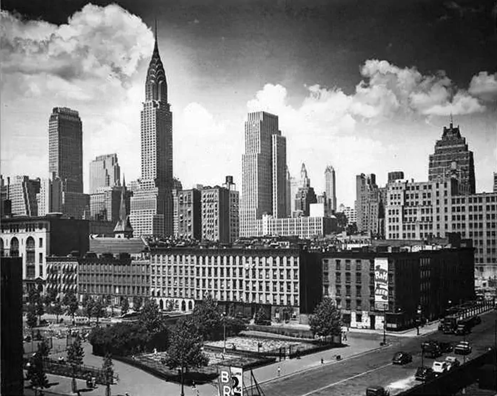
A 1930 look north shows part of the west side of St. Gabriel’s Park (below center) with the Chrysler Building in the year the building opened | Ewing Galloway

The steeple of St. Gabriel’s Catholic Church and the new Chrysler Building appear in 1931 in the background of the parkr, then named St. Gabriel’s Park | St. Vartan Park Conservancy collection
“St. Gabriel’s Park opened. Paved throughout with not a tree or blade of grass in sight, it was the first of many play spaces built exclusively for team-based sports and exercise classes.”
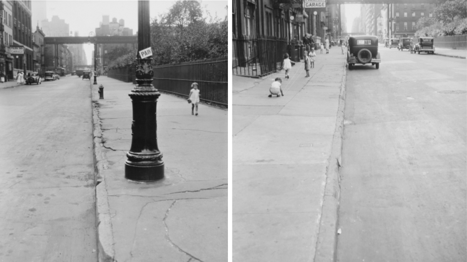
The park appears on the right of these two photos of East 35th Street between First and Second Avenues on August 13, 1932 | Office of the Borough President
“[Joseph Thomas] is the only voter in the Nineteenth Election District . . . he is receiving more consideration, from an official point of view, than any other voter in the United States . . . The conditions which made Thomas the monarch of all he surveys from a voting point of view was created by tearing down nearly all the residences in the election district to make room for St. Gabriel’s Park.”

The now-defunct East 36th Street school St. Gabriel (topped by a cross, second background building from right), faces the park in this view captured from East 35th Street in 1934 | P.L. Speer photograph courtesy of New York Public Library
“Although several members of St. Gabriel’s Catholic Church near by had opposed the name of Civic Park . . . to ‘St. Gabriel’s Park,’ the aldermen made the change yesterday. ”

This August 1, 1939, view from East 36th Street shows the park’s northeast entrance and an active horse water trough on First Avenue in front of the park’s garden | Photograph courtesy of MTA Bridges and Tunnels
“. . . one of the little-known parks on Manhattan Island will become better known to New York City residents . . . Four years ago or so, houses facing and adjacent to the park were sold from $12,000 to $15,000. They now command $50,000 . . . Factors that are calling marked attention to this property are the great commercial expansion in the Grand Central zone eastward, through the Forty-second Street area across Lexington and Third Avenues, and the assured activity in the easterly Thirty-fourth Street centre at no distant date. ”
“Thirty-one motion picture films, each devoted to some phase of health building, produced by the New York Tuberculosis and Health Association in cooperation with other health agencies, are to be shown, free of charge, in parks and outdoor recreation places in Manhattan and the Bronx [including] Aug. 3, St. Gabriel’s Park . . .”
The park west of First Avenue is seen in 1939, soon before the block across East 35th Street from the park was razed for construction of the Queens-Midtown Tunnel | Photograph by Alexander Alland courtesy of New-York Historical Society
“. . . directors of the First Avenue Association . . . explained that the proposed Thirty-fifth and Thirty-sixth Street [tunnel] entrance and exit plazas would directly adjoin St. Gabriel’s Park, which is between First and Second Avenues. The park, the committee pointed out, is one of the few breathing spaces in this congested section of the East Side. Its usefulness for park purposes would be at an end, the committee asserted, if streams of vehicles were constantly passing its borders on their way to and from the tunnel. Not only would the traffic prevent safe and easy access to the park, the report said, but the motor exhaust fumes would be an added objection. The committee’s proposal for use of the Thirty-seventh and Thirty-ninth Streets would leave the park undamaged . . .”
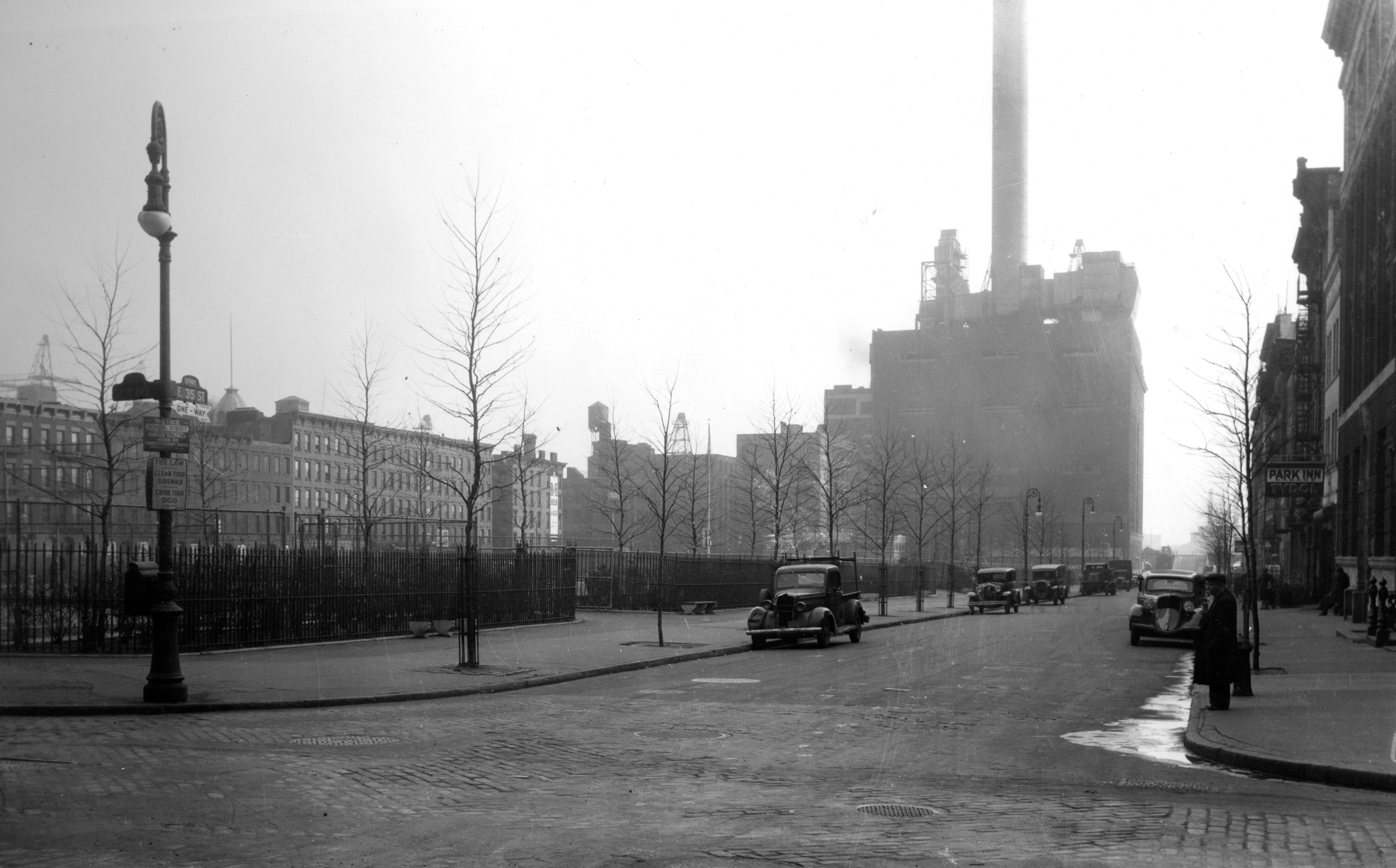
The south side of the park alongside East 35th Street is viewed from Second Avenue on January 7, 1939 | Photograph courtesy of MTA Bridges and Tunnels
“St. Gabriel’s Park, on First Avenue, opposite the steam plant, is one of the few recreational areas in the neighborhood.”
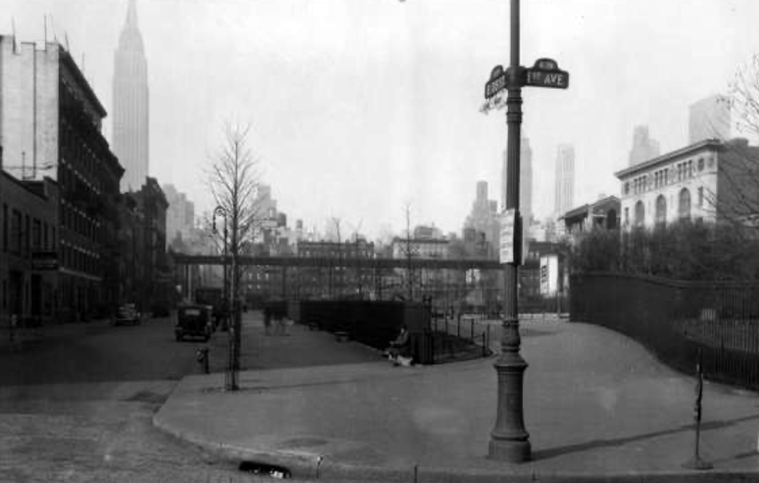
Park on right at First Avenue and East 35th Street, January 7, 1939 | Stomach Photo Service
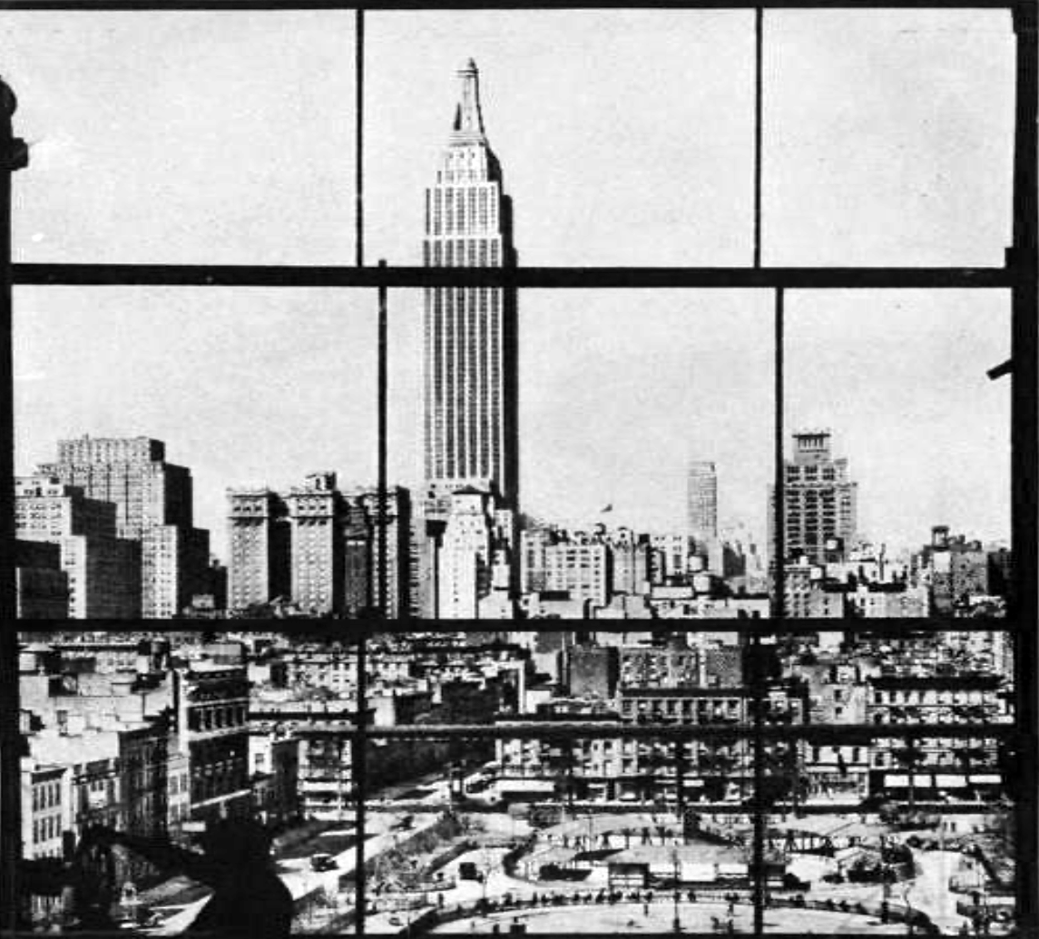
Park in lower right, 1932 | New York Steam Corporation
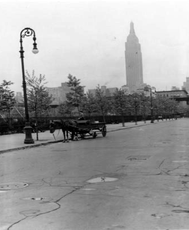
The park along East 36th Street, 1939 | P.L. Sperr

This January 8, 1939, view of the park from the intersection of East 35th Street and Second Avenue looks toward the since-razed Con Edison steam station on First Avenue | Photograph courtesy of MTA Bridges and Tunnels
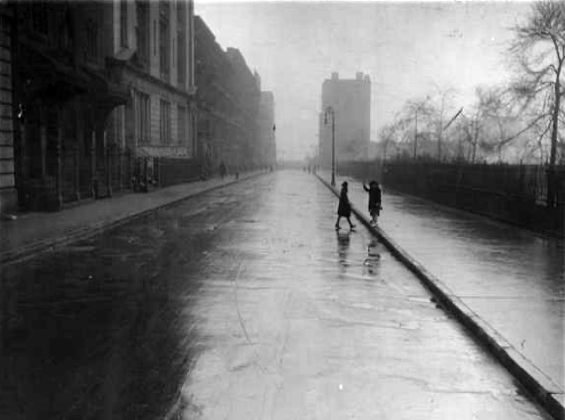
The park alongside East 36th Street, 1919 | New York Public Library
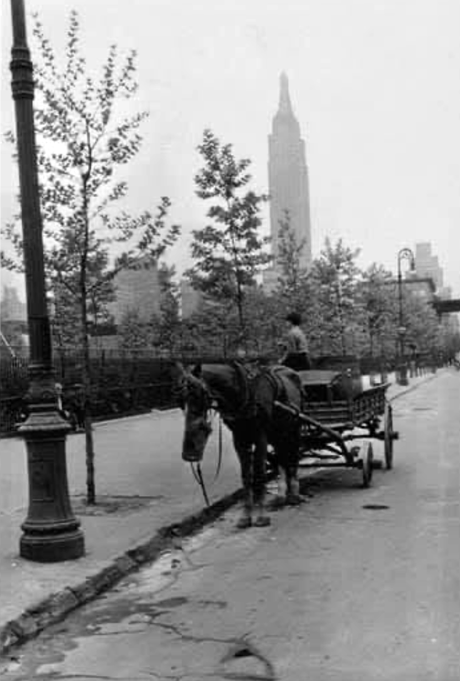
The park along East 36th Street, 1939 | P.L. Sperr
“Charging that the Queens Midtown Tunnel Authority had ‘carefully and deliberately neglected to tell me’ of its plan to use part of St. Gabriel’s Park on the East Side as an approach plaza for the tunnel, Park Commissioner Robert Moses angrily warned the authority yesterday that under no circumstances would he permit such use of the park . . . assailing the authority for ‘cold-bloodedly’ attempting to take the park, which occupies the block . . .”

The park extends from the top right of this November 19, 1940, view of work on the Queens-Midtown Tunnel near the Second Avenue elevated train line | Photograph courtesy of MTA Bridges and Tunnels
“Drafters of the New York City Tunnel Authority bill have stolen a march on Park Commissioner Robert Moses, it developed today . . . he can’t do anything about it . . . The bill passed [the New York] Legislature Tuesday, which authorizes construction . . .”

The creation of Tunnel Approach Street (above the park’s basketball court on right, intersecting with East 36th Street) for the 1940 Queens-Midtown Tunnel severed the formerly contiguous park | Photograph courtesy of MTA Bridges and Tunnels
“Remember that little patch of green between 35th and 36th Streets and First and Second Avenues in Manhattan? St. Gabriel’s Park, wasn’t it? That was the name yesterday. Now, however, it’s St. Vartan’s Park, to reflect the towering presence of St. Vartan’s Armenian National Cathedral on the opposite side of Second Avenue.”

The tree-lined park now known as St. Vartan Park appears one block above the under-construction Queens-Midtown Tunnel, which was opened in 1940 | Fairchild Aerial Surveys photograph courtesy of MTA Bridges and Tunnels
“Young professionals and families are flocking to Murray Hill . . . St. Vartan Park spans the area from East 35th to East 36th Streets and from First to Second Avenues . . . it is the largest park in Murray Hill, with baseball and football fields, as well as basketball and handball courts . . . Fred Arcaro, 75, a retired electrical engineer and president of the Manhattan East Community Association, has lived near First Avenue since 1989. He is hopeful that the growth will include more green spaces . . .”

St. Vartan Park is visible in 1940 one block below the new Queens-Midtown Tunnel — the tunnel to where the left superimposed arrow appears (King Features Syndicate added two arrows to the Fairchild Aerial Surveys photograph to indicate the location of the Manhattan and Queens entrances to the tunnel)
“Four small neighborhood parks , to be incorporated in the project of Borough President Miller for an East River drive, are urged by the municipal affairs committee of the New York League of Women Voters in a letter to Mr. Miller . . . one to each mile of the drive . . . the fourth being made by extending St. Gabriel’s Park. Such a plan would provide, the letter points out,. ‘a few breathing spaces in one of the most densely populated areas in the world.’ ‘We realize that the acquisition of even small park areas,’ the letter continues, ‘will add to the cost of the East River drive, but we believe and we know that you will agree that the children of Manhattan are worthy of at least as much consideration as its automobiles . . . The East River drive makes possible an extension of this program to the part of the city which needs it most.’”

St. Vartan Park was named for the domed St. Vartan Armenian Cathedral (center left, on Second Avenue between East 34th and East 35th Streets with green space from the park behind it) in 1978, more than six years after this view was captured | Photography courtesy of St. Vartan Park Conservancy collection
“Widely regarded as one of New York’s nicest neighborhood parks. You’ll enjoy plenty of shade from the plethora of trees, a big and spacious playground for families with young kids, nice baseball fields and basketball courts.”

More than a quarter century ago, St. Vartan Park appears west of the East River, Queens and Brooklyn, below a red-topped First Avenue Con Edison steam station whose demolition was completed in 1994 | Photograph from St. Vartan Park Conservancy collection
“Just like for Earth Day 2021, public school students and community organizations gathered this morning at St. Vartan Park to clean up the streets. The students from The River School PS 281 and PS 116 joined with their parents to fan out into the Murray Hill neighborhood with their garbage grabbers, picking up as much trash as possible.”
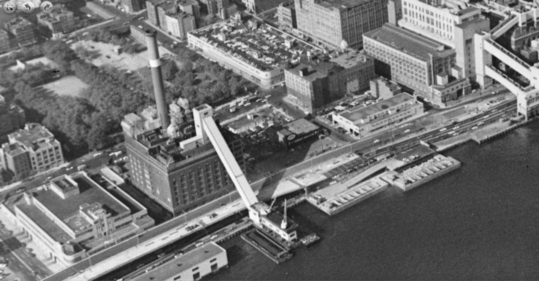
The park appears on the left on October 26, 1966 | New York Department of Ports and Trade
“If you’re thinking about moving to New York City, it can be hard to decide which of its many neighborhoods is the right fit for you. Murray Hill. . . is a bit more tranquil and out of the chaos of the heart of Midtown . . . a relatively small area of NYC, but you can stroll along the FDR for picturesque views of the East River or stop by St. Vartan Park . . .”
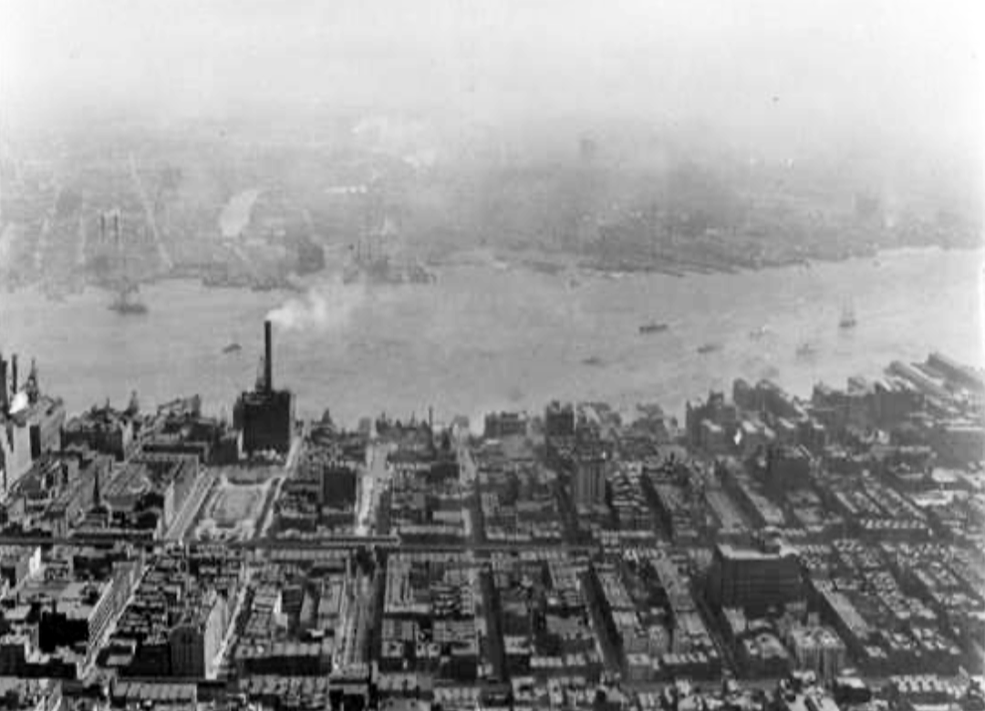
Park appears on left below a stack of the First Avenue Con Edison steam station, September 24, 1931 | P.L. Sperr
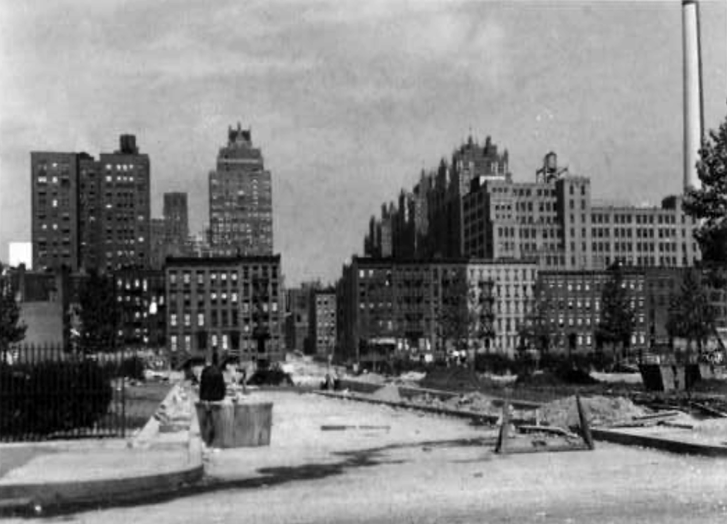
The building of Tunnel Approach Street that cut through the once-contiguous park, September 21, 1940 | P.L. Sperr
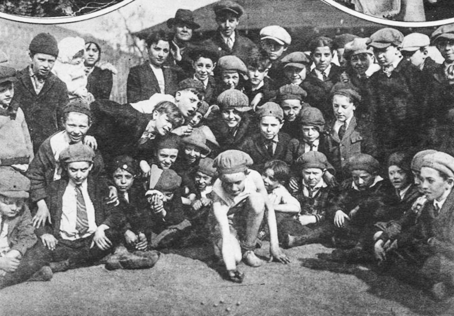
This clip from a 1926 issue of The New York Times’ publication Mid-Week Pictorial was captioned “AFTER THAT CHAMPIONSHIP: JOSEPH O’BRIEN, Who Will Represent St. Gabriel’s [now St. Vartan] Park, New York, in the Park Playground Marble Contest, Knuckles Down to Hard Practice for the Event” | Times World Wide pho
“. . . in the past few years, many more families with young children have been moving to Murray Hill . . . discovery of the 2.8-acre St. Vartan Park, with its big playground that is ’busy all day long,’ convinced [Eve Moskowitz Parness] that she had made the right decision to stay in Murray Hill.”
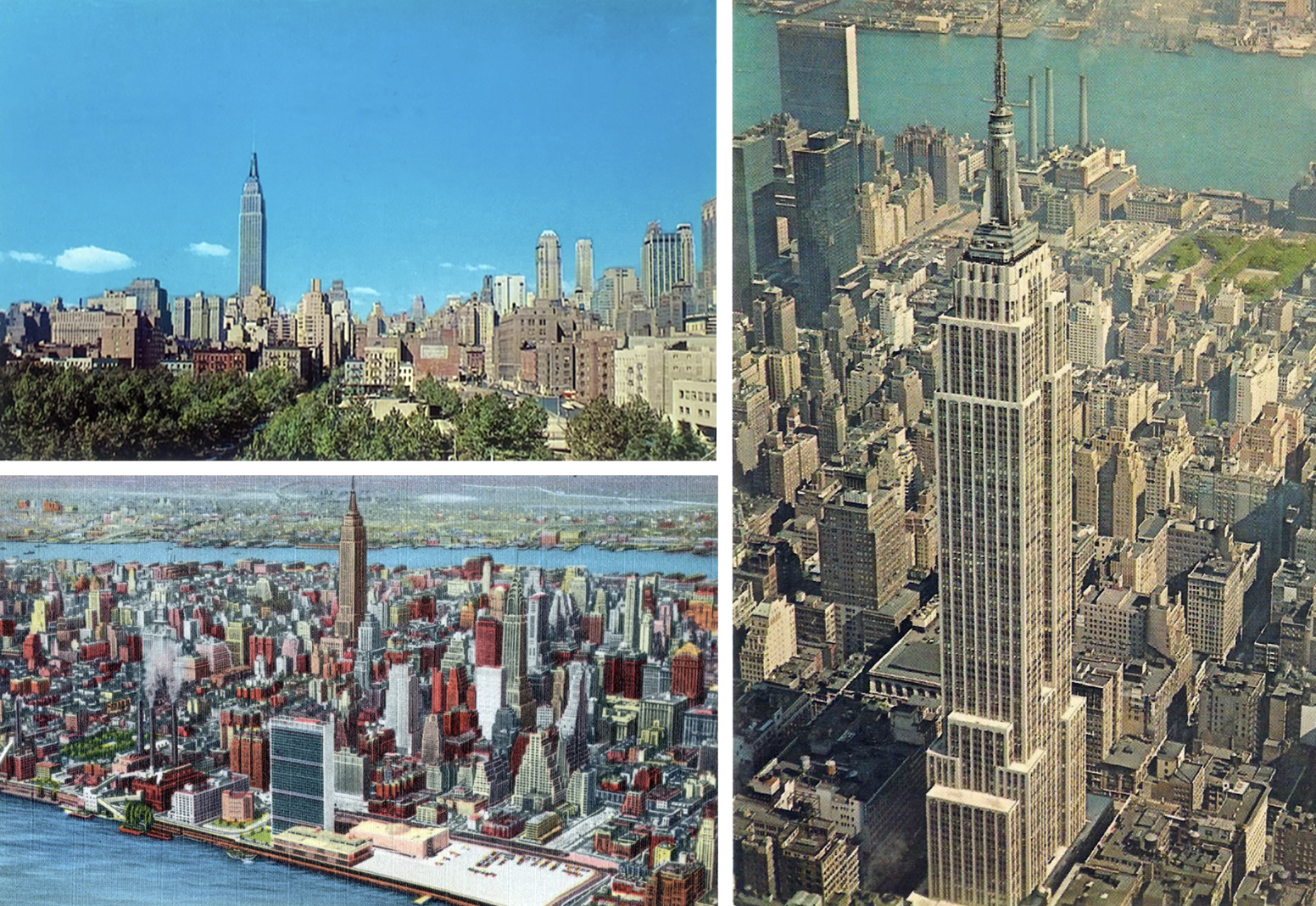
Green space in the park is visible on these three vintage postcards | Postcards from Manhattan East Community Association collection
“Take a break at St. Vartan Park, at 35th Street and First Avenue . . . features thousands of shrubs that were planted during a 1984 renovation and, in the northeast corner of the park, there sits a sculpture that is the very picture of harmony — a bird perched on the back of a lion.”
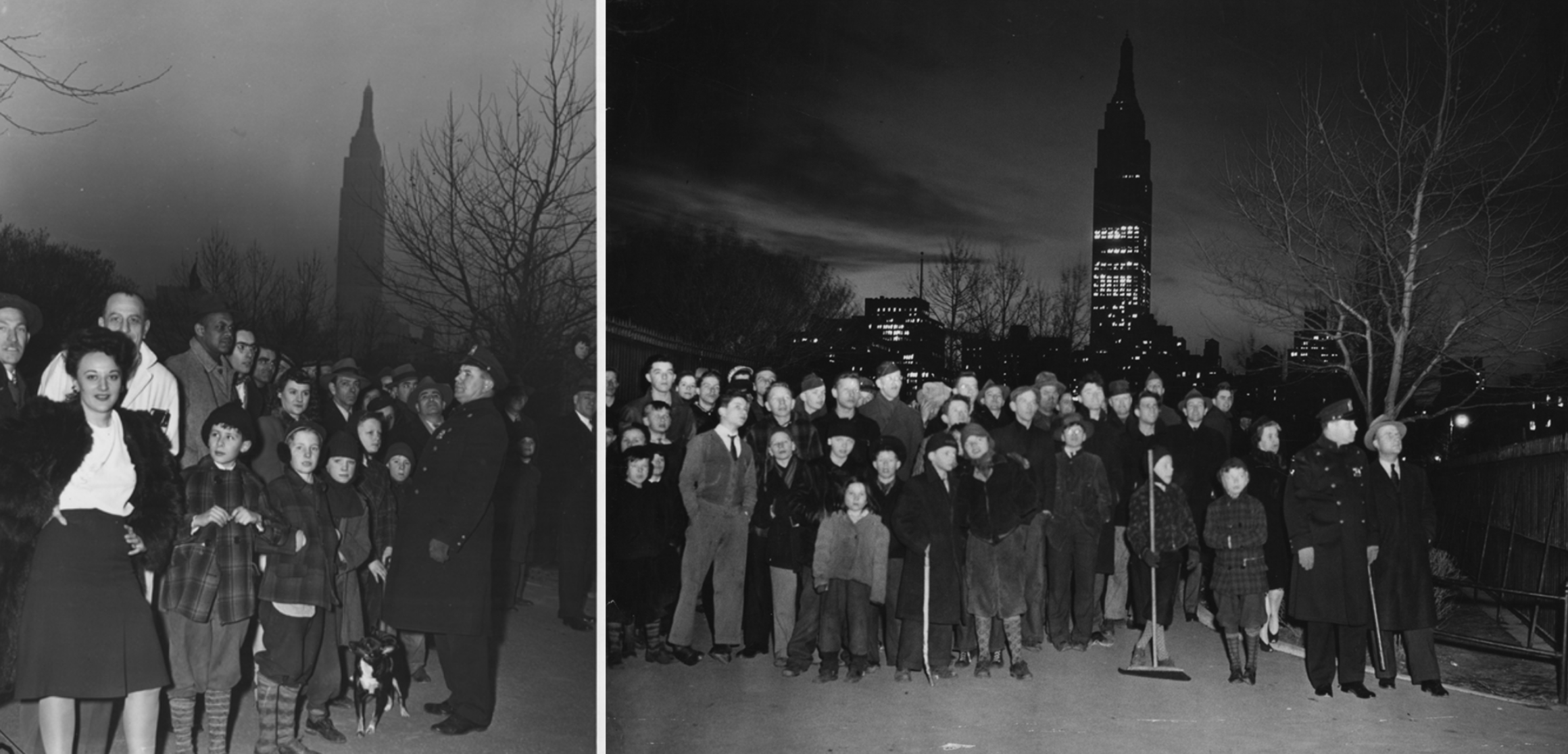
On March 1, 1944, a five-alarm fire at a bomber-plane parts factory at 411 East 36th Street attracts onlookers at the park | Weegee Collection photography courtesy of Getty
“In parks you may get an opportunity to understand your senses, stay with your thoughts and step away from hustle. One of these locations is St. Vartan Park . . . a boost of cheerfulness . . .”
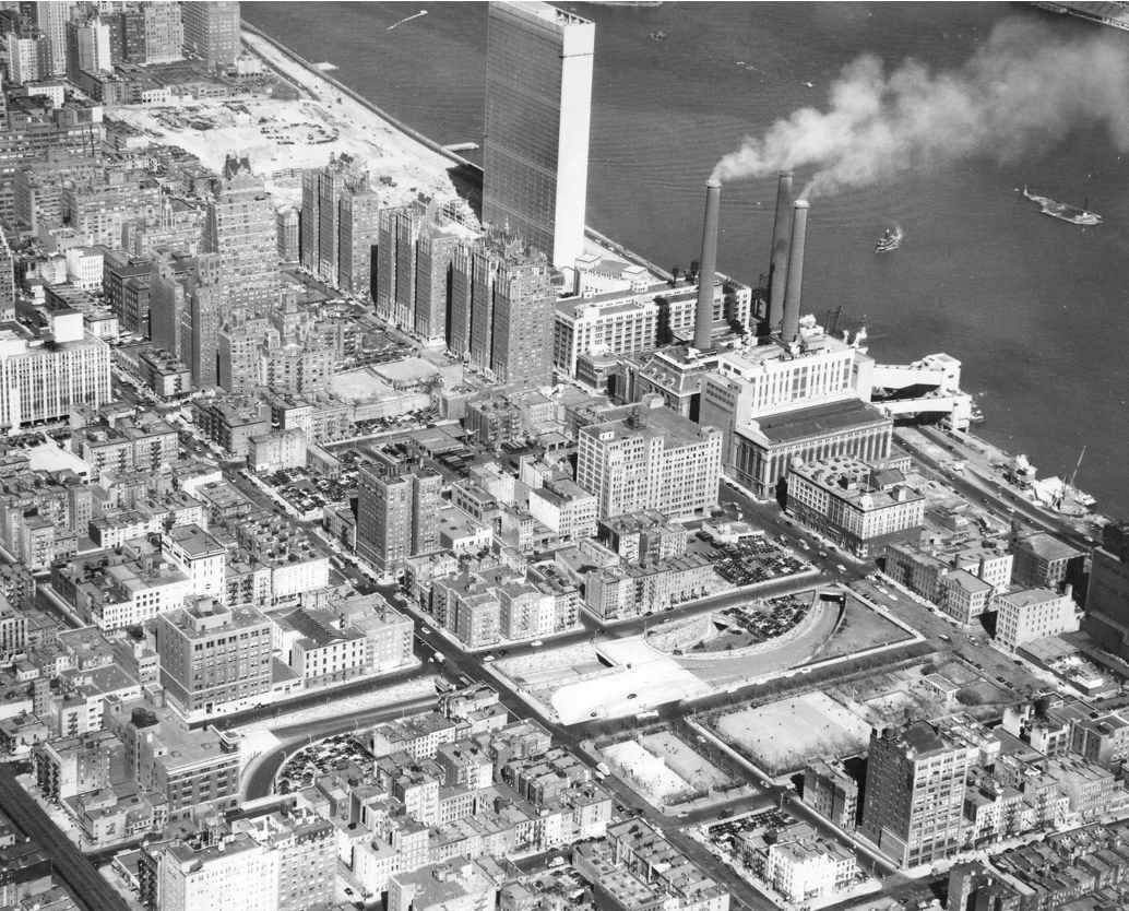
St. Vartan Park (bottom right) appears one block below the Queens-Midtown Tunnel, which was opened in 1940 | Fairchild Aerial Surveys photograph courtesy of MTA Bridges and Tunnels
“ . . waves of Irish immigrants settled around Second Avenue, as did a large population of Armenians, part of the reason the huge St. Vartan Armenian Cathedral was erected at the corner of Second Avenue and 35th Street . . . the Rev. Mardiros Chevian, who has been the cathedral’s dean since 1994 [said], ’I think the whole area has livened up.’ Part of that liveliness is centered on St. Vartan Park, which, though spare, has become a popular place for parents to take their children on weekends.”
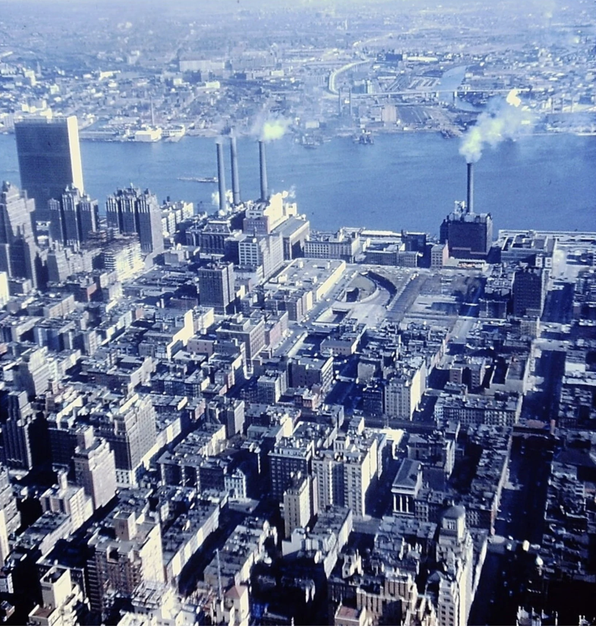
In 1955, St. Vartan Park (then St. Gabriel’s Park) appears west of the East River, Queens and Brooklyn, below a stack of the First Avenue Con Edison steam station whose demolition was completed in 1994 | Photograph from St. Vartan Park Conservancy collection
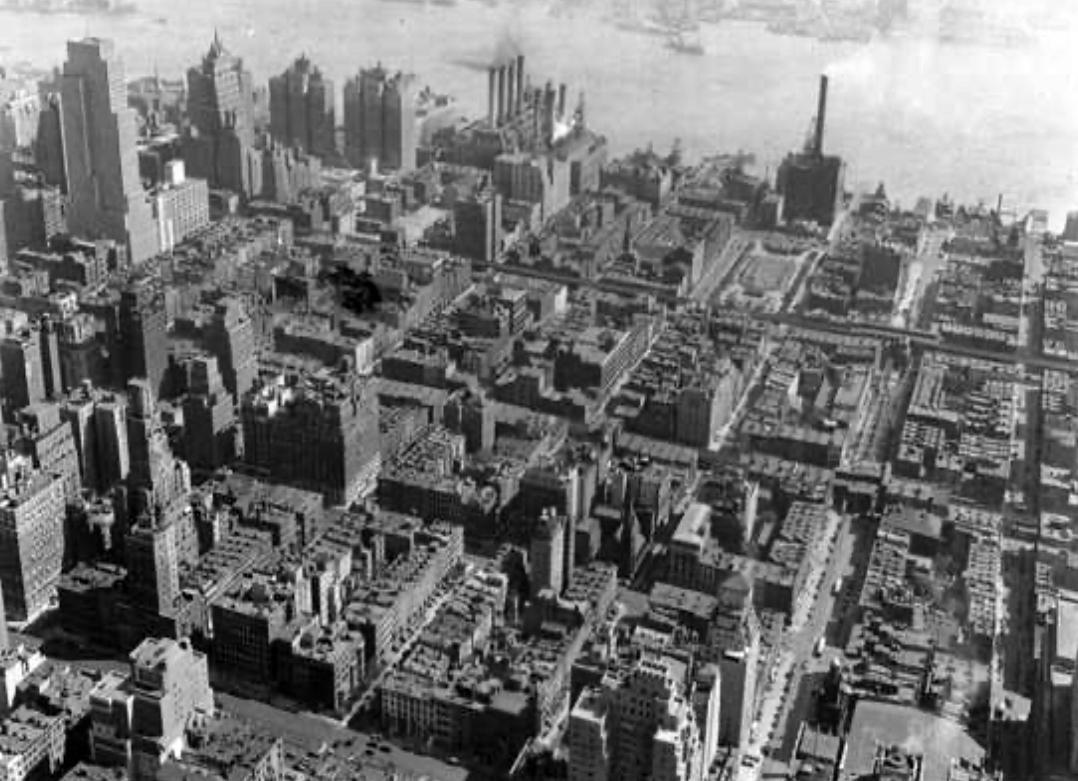
The park is shown below a stack of the First Avenue Con Edison steam station on September 24, 1931 | P.L. Sperr
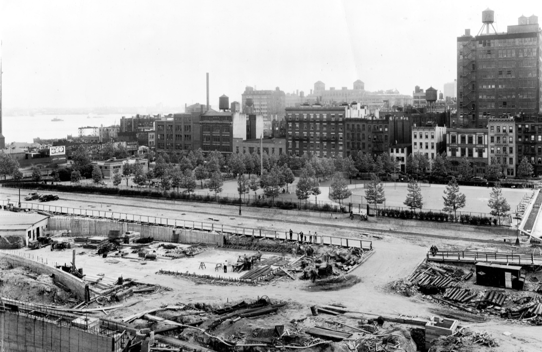
The tree-bordered park as seen on July 5, 1940 | P.L. Sperr
“one of the most heavily used breathing spaces in crowded Manhattan is bounded by 35th and 36th Sts. and First and Second Aves.””
The eastern portion of the park appears west of the East River on July 7, 1940, during the construction (foreground) of the Queens-Midtown Tunnel | Photograph courtesy of MTA Bridges and Tunnels
“. . . on Monday, August 10 . . . the westerly half of the [park’s] reconstructed area will open. Handball, shuffle board, horseshoe and basketball courts, parallel and horizontal bars, a roller skating track and a softball diamond are included in the facilities for older children. When the entire park in finished late this summer, there will be a completely equipped playground with wading pool and wide tree-shaded promenades paralleling 35th and 36th Streets.”
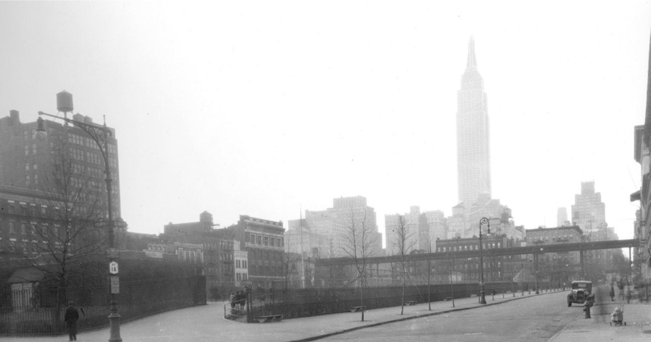
The park is captured from First Avenue and East 36th Street on January 8, 1939 | Photograph courtesy of MTA Bridges and Tunnels
“. . . park’s existence as a breathing space is very necessary . . . with mothers and babies, with baby carriages and little toddlers and energetic three and four-year olds . . . ””
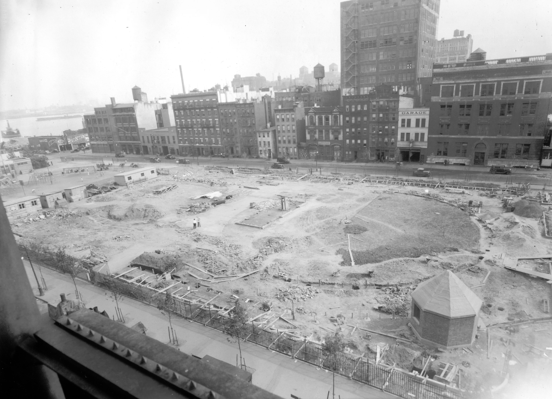
The park appears on July 3, 1936 | Photograph shot from the St. Gabriel’s branch of the New York Public Library courtesy of MTA Bridges and Tunnels
“This park was authorized in response to the plea for a breathing spot, by the dwellers of the middle east side of Manhattan . . . The park consists almost entirely of playgrounds . . . The young trees were cultivated and watered during the hot summer weather, and a hedge of privet, removed from Central Park, was planted along the fence surrounding the park . . .”
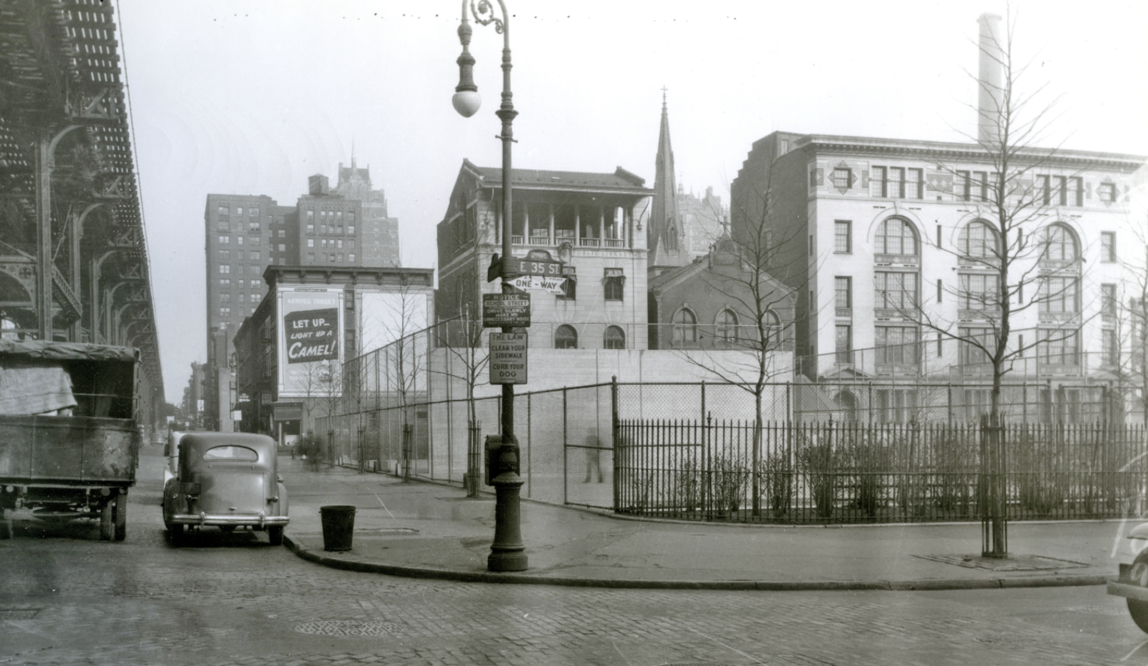
This January 7, 1939, view from the northeast corner of East 35th Street and Second Avenue includes the now-defunct Second Avenue train line (left) and the park’s handball wall | Photograph courtesy of MTA Bridges and Tunnels
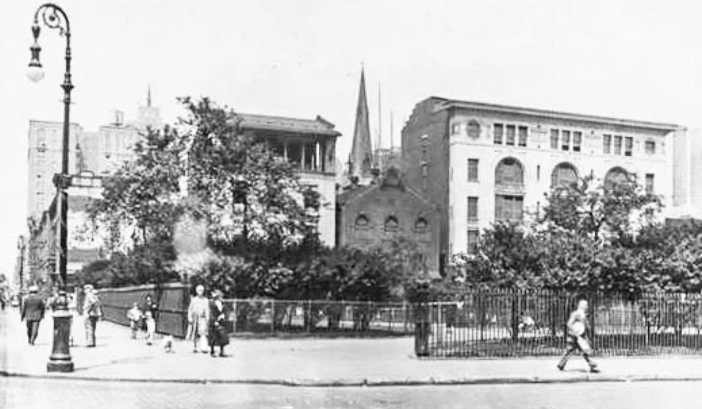
This June 6, 1929, view from the northeast corner of East 35th Street and Second Avenue shows a park entrance that was removed when a handball area was added seven years later | P. L. Sperr photograph
“There was filed in the Supreme Court yesterday a report of . . . Commissioners of Appraisement and Condemnation appointed to value and condemn the property to be acquired by the city for a park between First and Second Avenues, Thirty-fifth and Thirty-sixth Streets . . . The amount claimed by the property owners was $1,400,000. The valuation of the property as estimated by the city experts was $900,000, and the amount awarded by the commissioners is $1,028,000.”
“On a chilly evening earlier this month, hundreds of protesters gathered in St. Vartan Park in Manhattan’s Kips Bay neighborhood . . . It was crowded enough that some people had to stand atop the play structure in the back of the park. Speakers addressed the group, urging them not to give up the fight for trans rights, and to pressure CEOs and the government to uphold protections for trans children.”
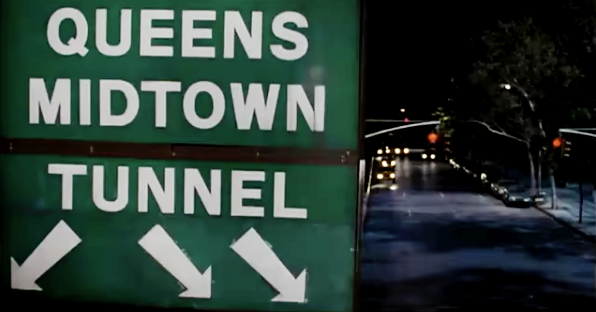

In the 1997 film ‘Men in Black,’ co-stars Tommy Lee Jones and Will Smith are portrayed riding in a speeding car (taking a right turn in right image) alongside St. Vartan Park on East 35th Street between First Avenue and Tunnel Approach Street on their way to the adjacent Queens Midtown Tunnel
